


On Britain’s largest warship, QR codes map the way
Finding your way around a shopping mall or football stadium can be hard enough – imagine having to navigate the windowless labyrinth of the two mammoth warships that will soon be part of Britain’s Royal Navy. Lucky for the crews working on those ships, there’s now a QR code-powered navigation system to guide them.
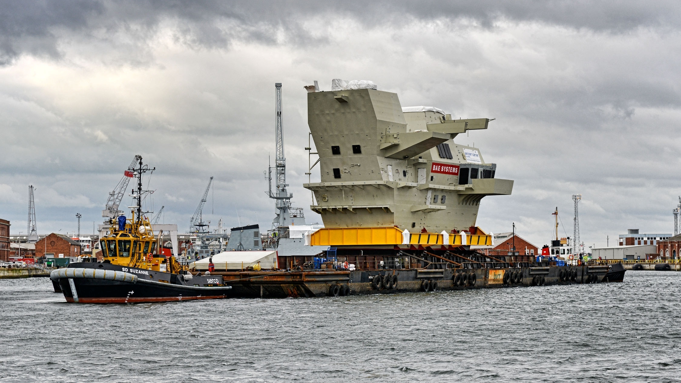
The bridge of the new Queen Elizabeth-class carriers, courtesy BAE Systems.
The two Queen Elizabeth-class carriers will be the Royal Navy’s largest warships to date, and are intended to lead its storied fleet for the next 50 years. Both ships are 306.21 yards (280 meters) long and 61.24 yards (56 meters) tall, with 3,000 compartments arranged on 12 decks. By comparison, an NFL-regulation football field is a measly 120 yards. I can’t imagine trying to get from one place to another on one of these ships without a map—but even a map would be of little use on a constantly changing construction site. Nor would GPS, which does not penetrate the ships’ interiors.
The QR code navigation solution was developed by engineers from BAE Systems, a global defense, security and aerospace company that is one of the principals in the Carrier Alliance, a partnership between industry and Britain’s Ministry of Defence, which is working on the warships. The first of the two carriers—HMS Queen Elizabeth — has been under construction since 2009, but the architects of the project have been planning, debating, reconfiguring and re-planning it since the 1990s. The official naming ceremony for the HMS Queen Elizabeth is scheduled for July 4. (Work on the second ship, HMS Prince of Wales, was begun in 2012, and is expected to be complete by 2018.)
The QR code navigation system came about when engineers working on the HMS Queen Elizabeth found that new workers and occasional visitors needed guides to reach their destinations within the ship. Traversing those 12 decks and 3,000 compartments can sometimes take 20 minutes, depending on the destination. Even experienced hands can run into problems if they need to get to a destination on the ship that they don’t usually visit, or if a well-known route is blocked by a construction project.
So BAE Engineers developed an encrypted QR code app that they named Platform Navigation (and quickly shortened to Plat Nav). It consists of some 3000 QR-coded tags affixed to the entrances of each of the aircraft carrier’s compartments. Before setting out for another location, the hopeful traveler scans the code with a smartphone, types in the destination, and receives a suggested route on the app.
Quoted in an article on the Platform Navigation app on the BAE website, Mick Ord, managing director at BAE Systems Naval Ships, said: “These are the largest and most powerful warships ever constructed for the Royal Navy so we need to keep finding smarter, safer and more efficient ways of working. Platform Navigation is a truly innovative device as it provides greater visibility within complex environments so that employees can concentrate on the task in hand, which for us means delivering the nation’s flagships.”
The BAE article noted that Platform Navigation “has the potential to be used inside other large ships and structures, both during and after construction – its ability to record inspections and patrols making it ideally suited for complex environments like hospitals or underground transport networks.”
Like this topic? Check out our related products:
-


Equipment ID Tags
Category: QR codes
